Before we even arrived at the White Mountain National Forest in New Hampshire, I was warned by a fellow traveler to make sure and purchase the state’s safe hiking card. That way, if I was injured in the backcountry and need rescuing, I wouldn’t be asked to pay the bill.
Not that I minded. It’s a reasonable $25 dollar fee ($35 for families). But as somebody who has hiked some pretty remote areas out in grizzly country and through remote canyons home to flash floods and all variety of poisonous things, I found it an odd ask.
Could New Hampshire’s trails really be that difficult?
One thing with the northeast, it never feels quite as remote as the expansive, sparsely populated stretches of the American West. But that northern stretch approaching the Canadian border and the sprawl of the Appalachians is proper wilderness, for certain.
We’d just left Vermont and I’d hiked a few peaks there. Mount Horrid was a vertical slog from parking lot to peak. And the entire last quarter mile of Mount Killington was rocky scramble up a steep, boulder-strewn slope – but rewards you with spectacular views of the Green Mountain range.
Sure, those trails were damp with spring run off. Lots of little brooks to cross. Mud to squish through. And Killington’s final 1/4 mile climb had been preceded by a pretty steep approach but on a very defined, largely level trail.
Up in New Hampshire though, they call this a trail.
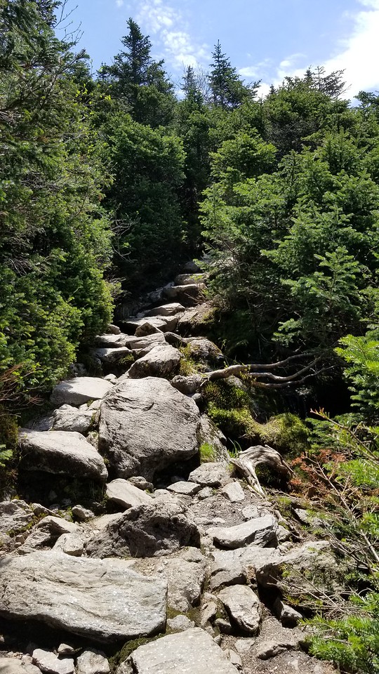
Oh, I know what you’re going to say. Gentle steps, all the way up! Like climbing the stairs!
Yes, exactly like climbing a stairwell. In a skyscraper. If you’re a toddler. And the stairs hit right about knee level.
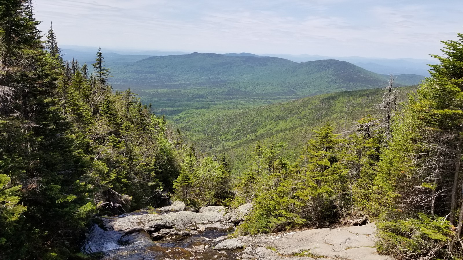
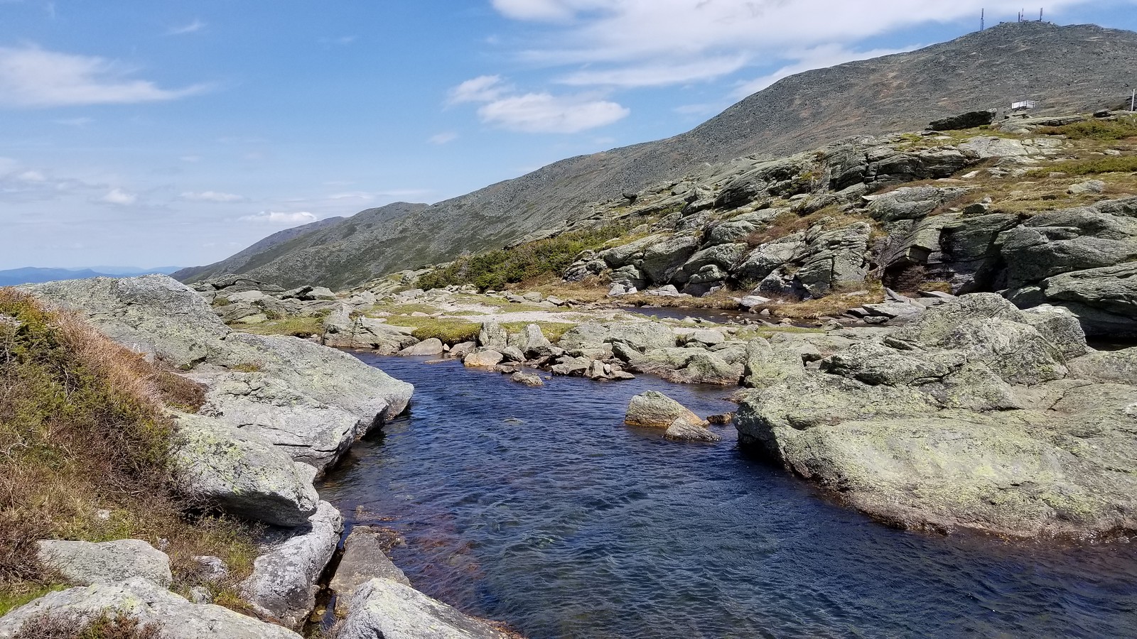
Evidently charted long before the invention of the switchback, the Lakes of the Clouds trail meanders along the Ammonoosuc River, a rocky spill of water that cascades down from a series of alpine lakes perched on the upper ridgeline 4000 feet above. Your job is to follow that river to the source.
If you’re cheap like me, you didn’t want to pay the $10 at the cog railroad parking lot and so you added a mile (two round trip) to a 4.5 mile out and back climb. That’s 6 plus miles of stairmaster for anybody keeping track.
In truth, the first couple miles aren’t that bad. Just lots of opportunities on the rocky, root-threaded trail to twist an ankle. Sprain a knee. End up a few miles from nowhere and have to, you know, call for those rescue services.
I get it now. I mean, I’ve hiked mountain passes and peaks across the U.S. They’re always tough, but this one is especially challenging from parking lot to summit. The peaks around Mount Washington are notorious for foul weather too, so I waited for a near perfect forecast.
But any sudden spring / summer storm (which can even mean freezing temperatures well into June) and those worn granite boulders would become slick, unforgiving.
Rescue services in White Mountain National must put in plenty of overtime.
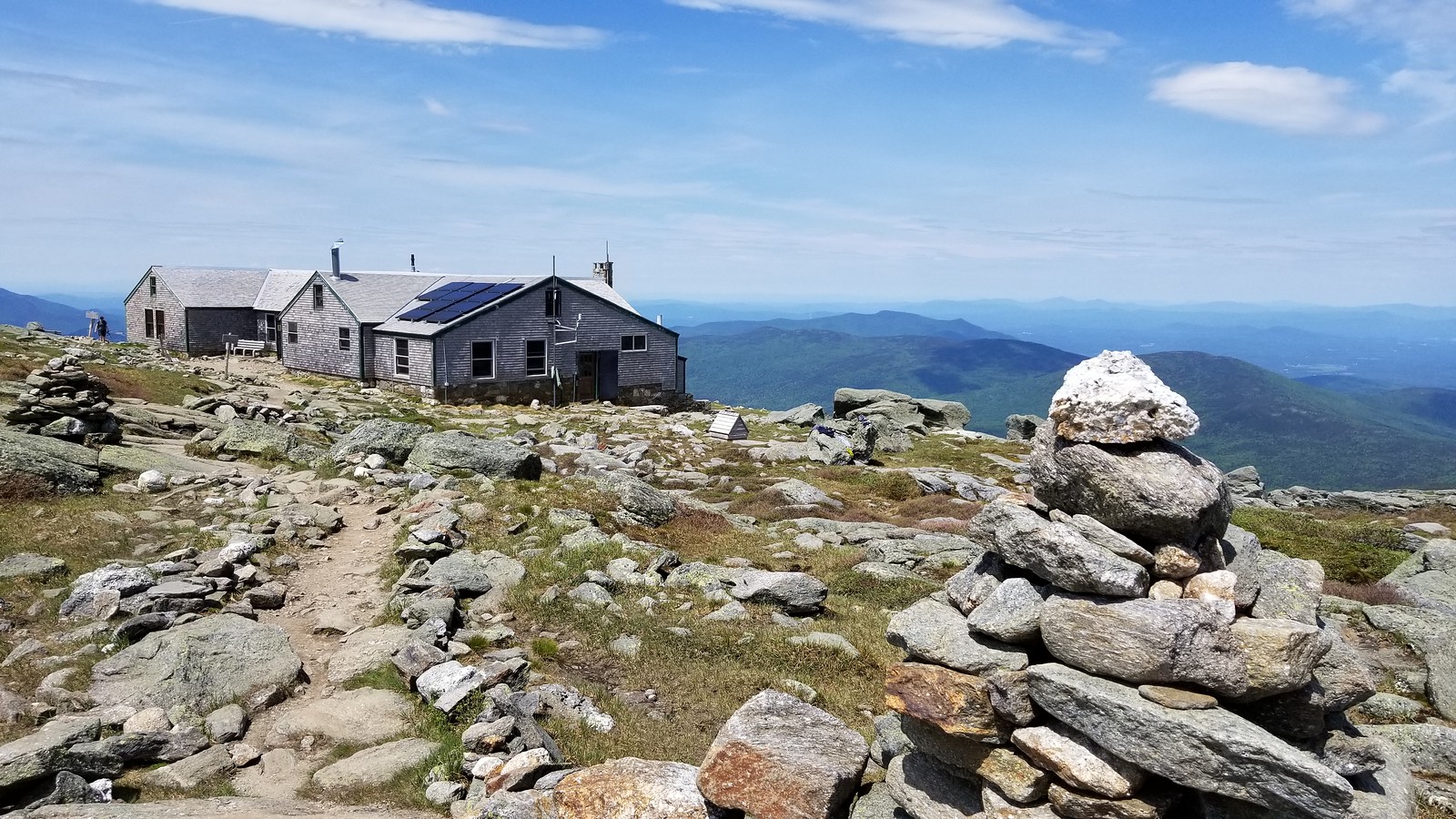
At the lakes, I briefly considered hiking the 1.5 miles to the top of Mount Washington and taking the cog rail down – those boulders weren’t going to be any easier on the return trip. I didn’t have plans to camp, but I’d brought my full backpacking gear because I’d rather not get used to not lugging it around mile after mile. Now, hauling it back down was starting to sound unappealing.
But while sipping coffee on the shore of one of those alpine lakes, I decided I might as well give the descent a go. I’d paid my $25 after all. I made the trek with a new found respect for these balding peaks, more muted than their Western cousins but no less challenging and certainly no less beautiful.


Leave a comment